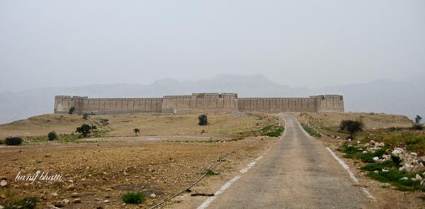
Ranikot Fort. Located about 30 km southwest of Sann, in the Kirthar Range, approximately 120 kms from Hyderabad Toll Plaza and 262 kms form Karachi. It is one of the largest forts in the world.
It has an approximate diameter of 9 km. Its walls are on the average 6 meters high and are made of gypsum and lime cut sandstone and total circumference is about 29 km. While originally constructed for bow and arrow warfare it was later expanded to withstand firearms.

It is reputed to be the largest unexplored fort in the world. The purpose of its construction and the reason for the choice of its location are still unknown.
Fort Ranikot is located in Lakki Mountains of the Kirthar range to the west of the mighty River Indus at a distance of about 30 kilometers from the present day town of Sann. A mountainous ridge, Karo Takkar (Black Hill), running north to south, forms its western boundary and the 'Lundi Hills' forms its eastern boundary. Mohan Nai, a rain-stream enters the fort from its rarely used western 'Mohan Gate', where it is guarded by a small fortification, changes its name to 'Reni' or 'Rani Nai' or rain-stream and gives the fort its name. Ranikot is thus the 'fort of a rain stream' - Rani. It runs through it, tumbles in a series of turquoise pools to irrigate fields and leaves the fort from its most used 'Sann Gate' on the eastern side. It then travels about 33 kilometers more to enter the Lion River - Indus.
Location:


